
Driving Independence Pass: Visiting the Continental Divide in Colorado

If you’re driving between Twin Lakes and Aspen, Colorado, one of the most memorable stops along the way is the Continental Divide at Independence Pass.
Located on Colorado State Highway 82, Independence Pass climbs to 12,095 feet above sea level as it crosses the Continental Divide in the Sawatch Range. The drive comes with alpine wildflowers, mountain views, hiking opportunities, wildlife, and more than a few curves that may have you reconsidering your relationship with guardrails.

We visited while exploring Twin Lakes and Leadville, Colorado, and the drive over Independence Pass became one of the highlights of the trip.
If you’re planning to drive it yourself, here’s what to know before heading up.
What Is the Continental Divide?
The Continental Divide is a natural boundary that separates major watersheds.
In simple terms, precipitation that falls on one side eventually flows toward one major body of water, while water falling on the other side heads in another direction.
The Continental Divide of the Americas, sometimes called the Great Divide, runs through the Rocky Mountains and extends from North America into South America.
Colorado has numerous places where roads and trails cross the Divide, and Independence Pass is one of the most scenic places to experience it by car.

At the summit, you can stop beside the Continental Divide sign and officially say you’ve stood at 12,095 feet with water flowing away in very different directions on either side.
Geography is considerably more entertaining when there’s a photo op involved.
Where Is the Continental Divide in Colorado?
The Continental Divide runs north to south through Colorado’s Rocky Mountains.
One of its most accessible crossings is at Independence Pass on Colorado Highway 82, between Twin Lakes and Aspen.
Independence Pass is the high point of the Top of the Rockies National Scenic & Historic Byway and sits in the Sawatch Range.
From the Twin Lakes side, Highway 82 climbs west toward the summit before descending toward Aspen.
That makes the pass especially easy to combine with visits to Twin Lakes, Leadville, or Aspen.
Driving Independence Pass
The drive across Independence Pass is gorgeous. It is also not what I would describe as relaxing.
Highway 82 climbs through forests and alpine terrain before reaching the Continental Divide. You’ll encounter curves, switchbacks, narrow sections of road, and steep drop-offs along the way.
Some sections near Aspen become particularly narrow, so drivers need to pay attention rather than staring at the scenery—which is admittedly difficult when the scenery looks like Colorado is showing off.
The road is paved, so you do not need a high-clearance or four-wheel-drive vehicle under normal conditions.
What you do need is patience, reasonable mountain-driving skills, and the ability to resist taking photographs while you’re supposed to be steering.
Vehicle Restrictions
There is an important restriction for oversized vehicles.
CDOT prohibits vehicles or combinations longer than 35 feet on portions of Independence Pass because of the narrow roadway and tight turns.
If you’re traveling in a large RV or towing a trailer, check current CDOT restrictions before planning this route.
For a regular passenger vehicle, SUV, or pickup, the road itself does not require special equipment during normal summer conditions.
When Is Independence Pass Open?
Independence Pass is seasonal.
Snow closes Highway 82 across the pass every winter. CDOT says the road typically closes around November 7 and almost always reopens on the Thursday before Memorial Day, although weather can cause earlier closures or delayed openings.
For the 2026 season, CDOT reopened Independence Pass on May 21, 2026.
That means you should never assume the pass is open simply because the calendar says spring or fall.
Before heading out, check current road conditions with CDOT.
Mountain weather has zero interest in your itinerary.
Best Time To Visit Independence Pass
For most travelers, summer through early fall is the easiest time to drive Independence Pass.
Summer brings greener scenery, alpine wildflowers, hiking opportunities, and generally more predictable access.
Late summer can be particularly beautiful around the summit, although weather can change quickly at elevations above 12,000 feet.
Early fall can bring brilliant Colorado color at lower elevations, particularly around the aspen groves.
Keep in mind that temperatures at the summit can be dramatically cooler than they are in Twin Lakes or Aspen.
We visited when the wildflowers were blooming, and the high alpine landscape was full of color.
How Long Does It Take To Drive Independence Pass?
The stretch of Highway 82 between Twin Lakes and Aspen is roughly 32 miles.
You could technically drive it without spending much time along the way, but that rather misses the point.
Allow extra time for:
- The Continental Divide summit
- Scenic pullouts
- Photos
- Short walks
- Wildlife sightings
- Independence Ghost Town
- Hiking stops
- Traffic on narrow sections of road
If Independence Pass is part of your sightseeing day, I’d avoid treating it merely as transportation between two places.
The road is the attraction.
What Is the Elevation at Independence Pass?
The summit of Independence Pass sits at 12,095 feet, making it one of the highest paved mountain passes in the United States.
And yes, you may notice the elevation.
If you’ve recently arrived from a much lower elevation, walk slowly and give yourself time to adjust.
Drink water and avoid charging up the first hill as though Colorado has personally challenged you to a duel.
Symptoms such as headache, dizziness, nausea, or unusual shortness of breath can be signs that your body isn’t enjoying the altitude nearly as much as you are.
The Continental Divide Summit
There is a parking area at the summit where visitors can stop and see the Independence Pass Continental Divide sign.

A short paved trail leads toward a scenic viewing platform in the high alpine tundra. The Forest Service lists the summit trail as a paved walk from the parking area to the overlook.
Even if you aren’t planning a serious hike, it’s worth getting out of the car.
The views stretch across mountains, valleys, and tundra, and being above 12,000 feet gives you that peculiar feeling of being simultaneously very small and extremely pleased with yourself for having arrived there in a vehicle.
Wildflowers Along Independence Pass
One of my favorite surprises was the wildflowers.
At first glance, the high alpine terrain looks harsh. Then you notice tiny flowers growing between rocks and covering sections of the tundra with color.

Summer is generally the best season for seeing alpine wildflowers in the area.
Because plants at these elevations have such a short growing season, please admire them from trails and established areas rather than stepping into the tundra for a photograph.

Those little plants are tougher than they look, but they don’t need us stomping on them for Instagram.
Wildlife at the Continental Divide
We also saw mountain goats during our visit.

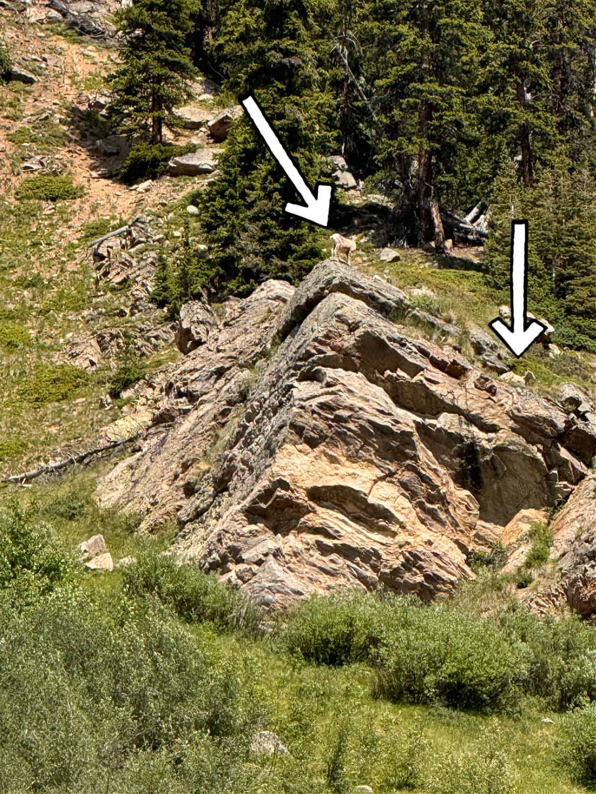
Watching them navigate rocky slopes makes humans look spectacularly underqualified for mountain living.
Wildlife sightings are never guaranteed, of course, but the high country around Independence Pass supports a variety of animals.
If you encounter wildlife, give animals plenty of space and don’t approach or feed them.
Zoom lenses exist for a reason.
Hiking Near Independence Pass
You don’t have to commit to an all-day mountain hike to stretch your legs around Independence Pass.
At the summit, the short paved trail to the viewing area is the easiest option.
There are also more substantial trails in the surrounding area for travelers who want to spend additional time in the high country.
The Continental Divide National Scenic Trail itself stretches roughly 3,100 miles between Mexico and Canada and passes through five states, including Colorado.
You certainly don’t need to hike 3,100 miles to enjoy the Continental Divide.
A short walk and a photograph at the sign will do nicely for the rest of us.
Independence Ghost Town
Another interesting stop along Highway 82 is Independence Ghost Town, located on the Aspen side of the pass.
The remains date to Colorado’s mining era and offer a completely different look at the mountains.
It’s an easy way to add a bit of history to a day that otherwise consists largely of saying things like, “Would you LOOK at that view?”
Do You Need Four-Wheel Drive for Independence Pass?
No.
During normal summer conditions, Independence Pass is a paved state highway, so a standard passenger car can make the drive.
Four-wheel drive and high ground clearance are not required simply to cross the pass.
Weather is the wildcard.
Snow, ice, storms, road work, or other conditions can temporarily affect travel even during the normal open season. Always check road conditions before heading up.
What To Bring
Even if you’re visiting in summer, bring a jacket or another warm layer.
Conditions above 12,000 feet can be much cooler and windier than they were when you started the drive.
I would also bring:
- Water
- Sunglasses
- Sunscreen
- Sturdy shoes
- A warm layer
- Snacks
- A camera or phone with plenty of storage
The stronger sunlight at high elevation is sneaky. You can feel downright chilly while getting a sunburn.
Yes, Even the Bathrooms Are Interesting
It isn’t often that I photograph public restroom doors, but Independence Pass apparently brings out the geography nerd in me.

The restroom doors near the summit were decorated with topographic contour lines, a clever little nod to the surrounding landscape.

It’s not exactly the Sistine Chapel.
But somebody made a bathroom door educational, and I respect the effort.
Tips for Driving Independence Pass Safely
Check the road before you leave. Even during the normal summer season, weather or road conditions can affect travel.
Keep your eyes on the road. The scenery will tempt you. That’s what pullouts are for.
Take narrow sections slowly. Don’t let an impatient driver behind you convince you that you’re suddenly competing in the Pikes Peak International Hill Climb.
Watch for cyclists. Independence Pass is popular with road cyclists, so expect to share the highway.
Don’t underestimate the altitude. Take your time at the summit.
Bring layers. Temperatures and weather can change quickly.
Other Places To Visit Near Independence Pass
A drive over the Continental Divide fits easily into a larger Colorado trip.
Twin Lakes
Twin Lakes, Colorado sits east of the pass beneath some of Colorado’s tallest mountains.
It’s a beautiful place for scenic views, outdoor recreation, and a quieter base for exploring this part of the state.

Leadville
Continue north to Leadville, one of America’s highest incorporated cities and an interesting stop for mining history, mountain scenery, shops, and restaurants.

Aspen
Drive west over the pass and Highway 82 eventually brings you into Aspen.
That means Independence Pass can connect two very different Colorado experiences: the quieter Twin Lakes and Leadville side and the considerably more polished Aspen side.
Is Independence Pass Worth Driving?
Absolutely—provided you’re comfortable driving mountain roads.
For us, the Continental Divide at Independence Pass wasn’t simply a sign beside the highway. The drive itself was part of the experience.
There were wildflowers, mountain goats, winding roads, enormous views, and that unmistakable Colorado feeling that whatever is around the next curve is probably going to make you stop the car again.
Just take your time.
At 12,095 feet, there’s really no need to hurry.
Final Call
Driving Independence Pass and standing at the Continental Divide was one of my favorite experiences from our time around Twin Lakes and Leadville.
Have you driven Independence Pass—or is there another Colorado mountain road that made you grip the steering wheel a little tighter than usual? Tell me about it in the comments.
